Sunday, December 8, 2013

Chapter 17: Pacific Northwest

Santa Clarita and Pacific Northwest


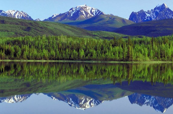
The Pacific Midwest is one of the smaller regions in North America.  It really only consists of half of Washington, half on Oregon, a small part of British Columbia in Canada, and the very small tip of the top of California.  Although small, this region is very much different than its neighbors: Intermontane and California. The presence of the US-Canadian border has had a great effect on the earlier life and settlement.  This area also is one of the smaller populated regions in North America due to its size.

Santa Clarita Climate and Pacific Northwest Climate


Due to it's marine climate, the Pacific Northwest is a very "wet" place to be.  This is not the same in comparison the the desert-like climate that is in Santa Clarita with it only averaging 0-5 inches monthly.  The Pacific Midwest is one of the wettest places in the United States.  They can have anywhere from 250 inches of precipitation annually.  This marine type climate is a result of their proximity  to their neighbors, the Rockies and the Pacific Ocean.  Due to this, a lot of their water comes from snowmelt, 70% of it to be more specific.

Chapter 16: Intermontane

Santa Clarita and Intermontane


The Intermontane is the "closest to home" without actually being home when should you compare it to Santa Clarita.  The Intermontane is directly west of Santa Clarita and includes the states of Nevada, Oregon, Washington, Utah, New Mexico, Arizona, a small part of Texas, and a small part of California.  Only the outermost eastern lip of California falls into the Intermontane line making it so that Santa Clarita misses it.


Santa Clarita Climate and Intermontane Climate


As we recall, Santa Clarita is very much effected by its desert climate.  This makes it very dry year round with little precipitation. The Intermontane is almost similar due to its position in between the Rocky Mountains and the Sierra Nevada.  This makes is so its dry and tough to live there because water is a little more scarce and needs to be put in reserve and have a close eye kept on.  It is a region characterized by canyons due to its volcanic formation.  We already understand that Santa Clarita can get as hot as low 100's with records even hitting 117 degrees, woah!

Chapter 15: The Rocky Mountains

Santa Clarita and the Rocky Mountains


Although one of the thinnest regions in the United States, the Rocky Mountains cover a lot of ground.  As one would guess by the name, the Rocky Mountains are characterized by their mountain features that stretch for more than 3,000 miles.  Mount Evert is the highest recorded peak within the Rocky Mountains at 14,440 feet high (or 4,400 meters).  One should not confuse this group of mountains with the Sierra Nevada, Cascade Range, and Pacific Coast range which all lie more to the west.  Santa Clarita does not share too many characteristics with the Rocky Mountains due to the geographic landscapes of the two.


 Santa Clarita Tourism and Rocky Mountain Tourism


Due to the mountains and the snowfall that occurs during the winter, the Rocky Mountains are now one of the best vacation spots in the United States for Skiing and snow resorts.  Thousands of Americans and international travelers head to lodges in the Rockies for their great slopes and challenges.


Being that Santa Clarita is pretty new, its largest and most well-known attraction would be its branch of the Six Flags company.  Within SCV, right off of the I-5 freeway, one can visit Six Flags Magic Mountain and Six Flags Hurricane Harbor.

Chapter 14: The Great Plains and Candian Prairie

Santa Clarita and The Great Plains and Canadian Prairie


The Great Plains and the Canadian Prairie begin to share more traits with Santa Clarita than a number of the other regions discussed.  Their location in North America is different, but their climates, human settlement, and industry are all greatly characterized by their dryness.  Both regions are looking into sustainability options that take advantage of the land around them especially when it involves the preservation and distribution and water.  The Great Plains and Canadian Prairie span a whopping 1,300,000 square kilometers which is noticeably larger than Santa Clarita's 62.16 square miles but this is obviously due to the fact that there are a number of states that are a part of this large central region.


Santa Clarita Climate and The Great Plains and Canadian Prairie Climate


Although different, the two areas do share a couple features for their climates.  Both Santa Clarita and the Great Plains and Canadian Prairie have dry climates that call for hot summers and cold winters.  Both receive little precipitation have dry winds that pass through them.  However, the pacific air in the great plains and Canadian prairie climate move eastward, so even more moisture is lost as is attempts to pass through the mountains.  This adds to the dryness of the wester plains that lack precipitation (yet remain a little more humid due to the Gulf Coast air)

Chapter 13: The Midwest

Santa Clarita and the Midwest


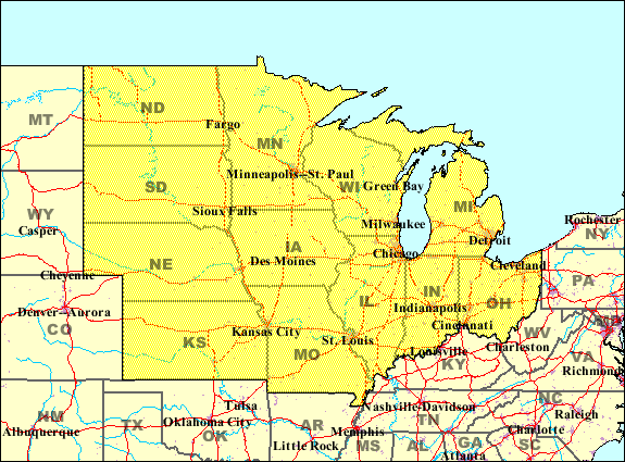
Also known as the North Central region, the Midwest of the United States consists of Illinoi, Indiana, Iowa, Kansas, Michigan, Minnesota, Missouri, Nebraska, North Dakota, Ohio, South Dakota, and Wisconsin.  The region maintains a fairly even balance between its agriculture and industry.  The "midwestern" term has been around since the 1880's and is a region that is often undecided when it comes to political elections.


Santa Clarita Population and Midwest Population

The population of the midwest is very large due to the fact that it has so many separate states within it.  It is one of the largest regions in the United States.  As of 2012, it is estimated that the total population of the Midwest region exceeds 65,370,000 people!  This region is so large that it is actually divided into two groups of states by the Census Bureau.


As stated earlier in the blog, its hard to compare the population of one region to a city, but to put it in comparison, the midwest region is 314 times more populous than Santa Clarita's population, wow!

Santa Clarita Lakes and Midwest Lakes

The Great lakes found in the Midwest are definitely on of the regions, if not the nation's, most known body of lakes.  The five great lakes that consist of the Great lakes are Superior, Michigan, Huron, Erie, and Ontario.  The only lake in Santa Clarita is Castaic Lake.

Chapter 12: The Ozarks

Santa Clarita and the Ozarks


The Ozarks contain the southern half of Missouri, a little bit of Illinois, part of Kansas, part of Oklahoma, and a large part of Arkansas.  The region, contrary to popular belief are a high and deeply dissected plateau although it is most commonly referred to as the Ozark Mountains.

Santa Clarita Water and the Ozarks Water

Santa Clarita relies on the Castiac Lake water agency and Alluvium and Saugus Aquifers for all of their water.  The acquisition of water isn't much of an issue for either area.  A lack of water is never an issue for the Ozarks, water is plentiful and can be found in most places.


The Ozarks are well known for their springs where more than 20 million gallons of water feed rivers daily.  The larges of these springs is the Southern Missouri Big Spring.  There are also Hot Springs in the Ouachita Mountains and Eureka Springs in Arkansas.  The rivers that define the Ozarks would be the Missouri River and the Mississippi River.

Santa Clarita Sustainability and Ozarks Sustainability

Originally, the Ozarks were a region known for their sustainability much earlier than the others.  Unfortunately do to the increase in population and similar environmental problems as the rest of America, the region has suffered a little.  Many programs have been set up to combat the man-made environmental effects that have taken place because of all of the industrialization though food processing, retail, community construction and tourism.


These similar environmental problems effect Santa Clarita which has initiated the set up on programs that inform and educate many about water preservation, the advantages of the acquisition of geothermal energy, the benefits of solar energy, and most important, the need to keep water clean and available

Chapter 11: Gulf Coastal Plains and Mississippi Valley

Santa Clarita and Gulf Coastal Plains/Mississippi Valley


Louisianna, Texas, Mississippi, Florida, and Alabama are all part of the Gulf Coastal Plain.  The population lost 379,032 people because of Hurricane Katrina. It's southern border is the Gulf of Mexico.  The Gulf Coastal Plains are characterized by the dominance of pine as well as the southern tropical and subtropical climates that allow for moist wetlands, marshes, and swamps.

Santa Clarita Climate and Gulf Coastal Plains Climate

Both areas have completely opposite climates.  The Gulf Coastal Plain's climate is is a result of its proximity to the Gulf of Mexico and the Atlantic Ocean.During Growing season, thunderstorms and lightning storms are daily occurrences. The regions warm humidity in combination with its nearness to the ocean create the hurricanes that characterize the region, the worst and most notable of these being hurricane Katrina.


  Santa Clarita's naturally dry climate makes it so these two are very distinguishable from each other.  While the Gulf Coastal Plains main natural threat is the hurricane influenced by its nearness to the Gulf of Mexico and the Atlantic Ocean, Santa Clarita is only at danger because of its nearness to the San Andreas fault (earthquakes).  The average precipitation of the Gulf Coastal Plains during the winter and spring can be as high as 90 inches.

Santa Clarita Population and Gulf Coastal Plains Population

As with all of the other regions, it is very difficult, almost unfair to compare the populations of a large region with that of a city in a state, but it can be assumed that the Gulf Coastal Plains population is very high.  Coming in at one of the most populous regions in the US, the Gulf Coastal Plains and Mississippi Valley have a population that exceeds 10,000,000!